

San Diego has over 100 miles of trails within city limits — from ocean cliffs to desert canyons, slot canyons to lagoon wetlands — and most are reachable from downtown in under 40 minutes. Whether you want a flat coastal walk with zero elevation, a beginner-friendly summit, or a full-day backcountry challenge, this guide cuts through the noise.
Quick Answer
- Most popular overall: Cowles Mountain — San Diego’s highest city summit, 3 mi RT, 950 ft, free parking
- Best easy coastal walk: Coast Walk Trail (La Jolla) — 2.5 mi, flat ocean cliffs, no fee, dogs welcome
- Best flat walk (no elevation): Tecolote Canyon — shaded, unknown to tourists, 12 min from downtown
- Best moderate hike: Iron Mountain (Poway) — 6.6 mi, wildflowers in spring, free parking
- Most photogenic: Potato Chip Rock (Mt. Woodson) — San Diego’s most Instagrammed summit
- Permits required: Cedar Creek Falls and Three Sisters Falls — free via recreation.gov, book 3–7 days ahead
| Trail | Difficulty | Distance | Elevation | Drive from Downtown | Parking | Dogs |
|---|---|---|---|---|---|---|
| Coast Walk Trail (La Jolla) | Easy | 2.5 mi | Flat | 20 min | Free street | ✅ |
| Sunset Cliffs Walk | Easy | 1.5 mi | Flat | 10 min | Free street | ✅ |
| Balboa Park 7-Bridge Walk | Easy | 4.5 mi | Minimal | 5 min | Free / Paid lots | ✅ |
| Mission Bay Loop | Easy | 5.0 mi | Flat | 15 min | Free | ✅ |
| Tecolote Canyon Trail | Easy | 3.5 mi | Low | 12 min | Free | ✅ |
| San Dieguito Lagoon Trail | Easy | 4.1 mi | Flat | 30 min | Free | ✅ |
| Palm Canyon (Balboa Park) | Easy | 1.0 mi | Flat | 5 min | Free / Paid | ✅ |
| Torrey Pines — Guy Fleming | Easy | 0.9 mi | Low | 20 min | $12–$25 | ❌ |
| Torrey Pines — Razor Point | Easy | 1.2 mi | Low | 20 min | $12–$25 | ❌ |
| Rose Canyon Trail | Easy | 2.5 mi | Low | 18 min | Free | ✅ |
| Bayside Trail (Cabrillo NM) | Easy | 2.5 mi | Gentle | 15 min | $25/vehicle | ✅ |
| Batiquitos Lagoon Trail | Easy | 3.4 mi | Flat | 40 min | Free | ✅ |
| Annie’s Canyon | Easy–Mod | 1.8 mi | 200 ft | 30 min | Free | ✅ |
| Cowles Mountain | Moderate | 3.0 mi | 950 ft | 20 min | Free | ✅ |
| Mission Trails — Climbers Loop | Moderate | 4.2 mi | 650 ft | 20 min | Free | ✅ |
| Torrey Pines — Broken Hill | Moderate | 3.3 mi | 350 ft | 20 min | $12–$25 | ❌ |
| Los Peñasquitos Canyon | Moderate | 6.2 mi | Low | 25 min | Free | ✅ |
| Iron Mountain (Poway) | Moderate | 6.6 mi | 1,000 ft | 35 min | Free | ✅ |
| South Clevenger Canyon | Moderate | 5.0 mi | 800 ft | 45 min | Free | ✅ |
| Stonewall Peak (Cuyamaca) | Moderate | 4.4 mi | 900 ft | 60 min | $10/vehicle | ✅ |
| Daley Ranch Loop (Escondido) | Moderate | 7.0 mi | 700 ft | 50 min | Free | ✅ |
| Potato Chip Rock — Lake Poway | Hard | 7.5 mi | 1,500 ft | 40 min | Free–$10 | ✅ |
| Cedar Creek Falls | Hard | 5.5 mi | 1,200 ft | 55 min | Permit req. | ❌ |
| Three Sisters Falls | Hard | 5.0 mi | 1,400 ft | 60 min | Permit req. | ❌ |
| El Cajon Mountain | Hard | 10.4 mi | 4,000 ft | 45 min | Free | ⚠️ |
Torrey Pines State Natural Reserve does not permit dogs on dirt trails — leashed dogs are allowed in parking areas and paved sections only. El Cajon Mountain technically allows dogs but is not recommended due to extreme heat and steep terrain.
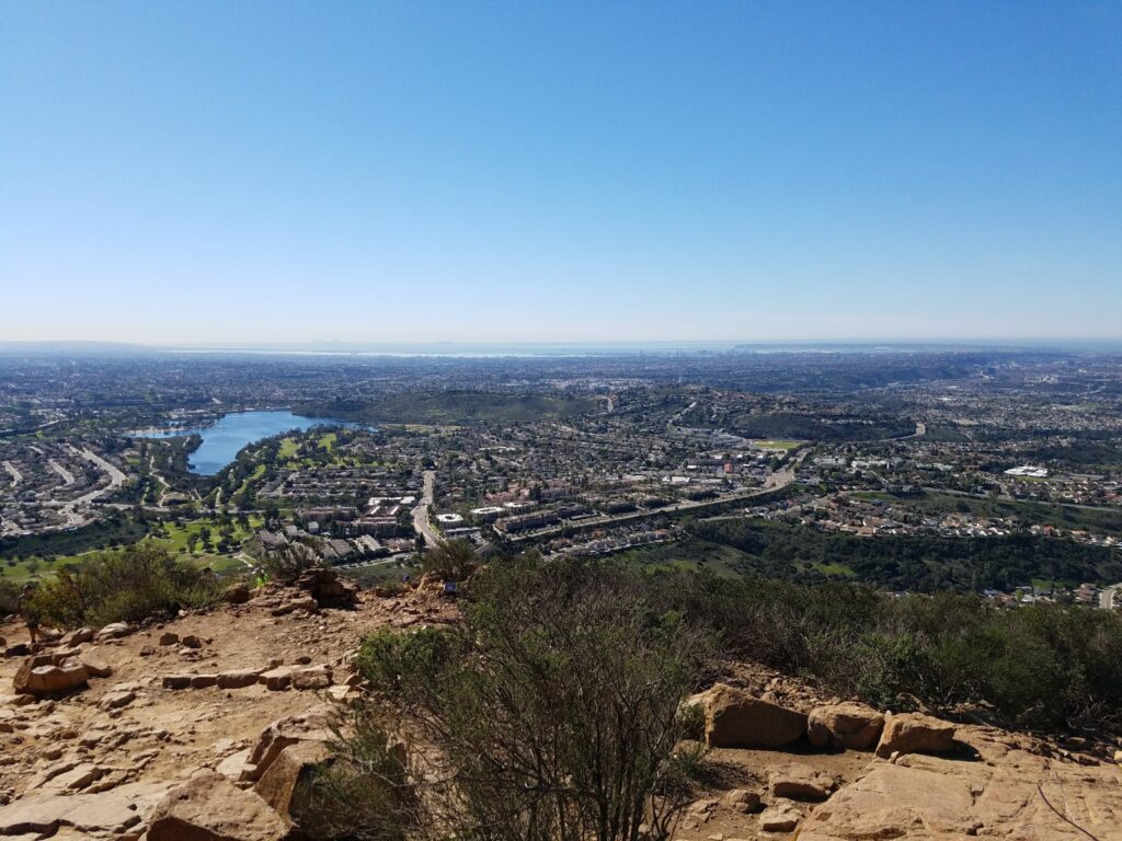
Explore San Diego Hiking Trails on the Map
With trails spread from the Pacific coastline to the inland mountains of Julian and Palomar, knowing where each trailhead is located helps you plan smarter. Use the interactive map below to explore hiking areas by region — from the urban canyons of San Diego proper to the rugged backcountry of the Cuyamaca and Laguna Mountains. Click any marker to see the trail name, address, phone number, and a direct link to its full profile.
Tip: Many of San Diego’s best trails cluster in specific zones — Mission Trails Regional Park, Torrey Pines, and the Black Mountain area each offer multiple hikes within minutes of each other. Group your hikes by region to maximize your day and minimize drive time.
Looking for a trail closer to where you’re staying? Browse our full Hiking Trails Near Me directory to find trailheads across all San Diego neighborhoods — with addresses, contact info, and detailed profiles for each location.
Best Flat Walks and Scenic Strolls in San Diego
The best flat walks in San Diego aren’t consolation prizes for non-hikers — they’re some of the most scenic routes in the city. Zero elevation, paved or packed dirt, ocean or lagoon views, and most of them are completely free. This is what locals mean when they say San Diego is a walking city.
1. Coast Walk Trail — La Jolla
Distance: 2.5 mi · Elevation: Flat · Drive from downtown: 20 min · Parking: Free street · Dogs: ✅
Best for: Ocean views, couples, first-time visitors, photography
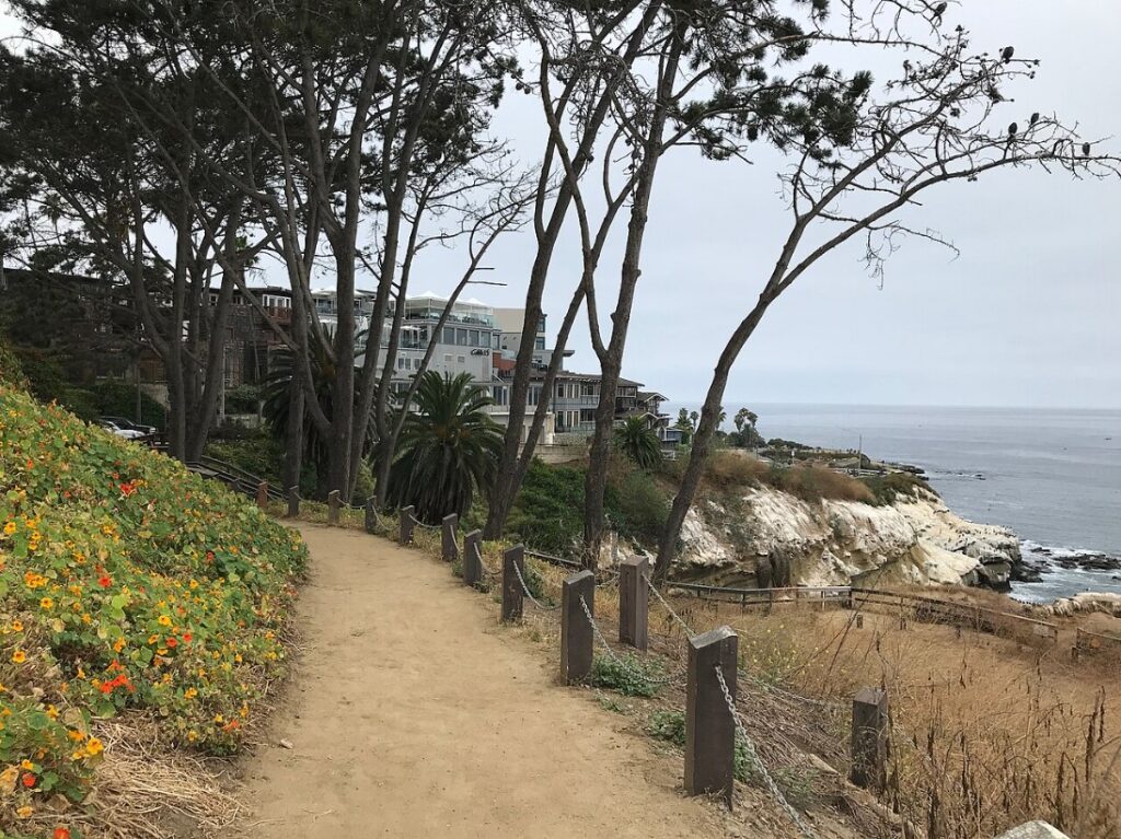
This is the most scenic flat walk in San Diego — a clifftop path running between La Jolla Shores and La Jolla Cove with unobstructed views of the Pacific the entire way. The trail passes the La Jolla sea caves, sandstone bluffs, and the resident sea lion colony at the Cove. No fee, no permit, minimal elevation.
Park on Coast Boulevard near the La Jolla Cove parking area — free street spots are available early morning and after 5 PM. The trail connects to the La Jolla Shores promenade on the north end, making it easy to extend in either direction. For restaurants, parking details, and nearby spots, browse places to visit in La Jolla.
2. Mission Bay Loop
Distance: 5.0 mi · Elevation: Completely flat · Drive from downtown: 15 min · Parking: Free · Dogs: ✅
Best for: Dog walks, runners, families with strollers, car-free option via bus
The paved bayfront path around Mission Bay is the most used flat walking route in the city — and one of the few that’s legitimately stroller-friendly, wheelchair accessible, and dog-friendly all at once. You’re walking around a protected bay, not the ocean, so there’s no wind or surf to deal with. The water views toward the bay bridge and the Downtown skyline are quietly excellent.
Best accessed from Vacation Road, De Anza Cove, or Mission Bay Park along East Mission Bay Drive. Multiple free parking lots throughout. Bus Route 8 stops at several bay access points if you’re coming without a car.
3. Sunset Cliffs Natural Park Walk
Distance: 1.5 mi · Elevation: Flat · Drive from downtown: 10 min · Parking: Free street · Dogs: ✅
Best for: Sunset views, couples, photographers, casual evening out
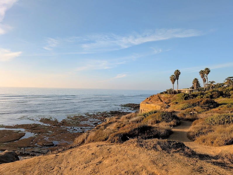
San Diego’s most atmospheric easy walk. You trace the edge of eroded sandstone cliffs above the Pacific — tide pools below, pelicans at eye level, and one of the best sunset views in Southern California. Park on Sunset Cliffs Boulevard and walk south. Best stretch: Ladera Street to Osprey Street.
Come Tuesday through Thursday if you want space — weekends get dense around golden hour. And stay back from the edges: the cliffs erode continuously, several sections are seasonally roped off. For precise sunset timing to plan your walk, see our San Diego sunset time guide.
4. Palm Canyon Trail — Balboa Park
Distance: 1.0 mi · Elevation: Flat · Drive from downtown: 5 min · Parking: Free / Paid lots · Dogs: ✅
Best for: Urban explorers, shaded hot-day walk, unique plant life
Most people walk Balboa Park’s central mesa and miss the Palm Canyon entirely — a shaded grove of 450+ Canary Island date palms tucked into a canyon below the main park level. It’s genuinely cool under the canopy on a hot day, and the scale of the palms is surprising. Short loop, completely flat, free.
Enter from the Pan-American Plaza parking area near the Air and Space Museum. Combines well with the Balboa Park Seven Bridges Walk as a cooler detour.
5. Batiquitos Lagoon Trail — Carlsbad
Distance: 3.4 mi · Elevation: Flat · Drive from downtown: 40 min · Parking: Free · Dogs: ✅
Best for: Bird-watching, flat nature walk, North County day trip
Batiquitos Lagoon is a California coastal lagoon reserve in Carlsbad — home to nesting great blue herons, snowy egrets, and migratory shorebirds. The trail follows the lagoon’s northern shore on flat packed dirt, with interpretive signs and water views throughout. It’s one of the most peaceful flat walks in San Diego County, and almost completely unknown to visitors.
Trailhead is at the Gabbiano Lane parking area off Batiquitos Drive in Carlsbad. No fee, no permit. Best from October through April for bird-watching.
6. San Dieguito Lagoon Trail — Del Mar
Distance: 4.1 mi · Elevation: Flat · Drive from downtown: 30 min · Parking: Free · Dogs: ✅
Best for: Wetland birding, flat walking near the coast, quiet midweek option
Another coastal lagoon trail that flies under the radar — this one in Del Mar, right behind the racetrack. Flat wetland path through native marsh restoration with egrets, herons, and migratory waterfowl depending on the season. 30 minutes from downtown, free parking, rarely crowded even on weekends.
Best Easy Hikes in San Diego
Easy hikes in San Diego go beyond flat walks — they include short trails with some gentle elevation, viewpoints, and natural features that reward a modest climb. These are strong picks for first-time visitors, families with older kids, seniors, or anyone who wants real scenery without committing to a workout.
7. Balboa Park — Seven Bridges Walk
Distance: 4.5 mi · Elevation: Minimal · Drive from downtown: 5 min · Parking: Free inside the park · Dogs: ✅
Best for: Urban hiking, no-car options, first-time visitors, history
Seven historic bridges, botanical gardens, sculpture galleries, and the canyon trails that most tourists never find — this walk covers more of Balboa Park than most people see in multiple visits. Start at the Cabrillo Bridge and work through Maple Canyon, Florida Canyon, and the central mesa. About 90 minutes at a comfortable pace.
Walkable from Hillcrest and Bankers Hill without a car. Browse parks near Balboa Park for what else is in the area.
8. Tecolote Canyon Trail
Distance: 3.5 mi · Elevation: Low · Drive from downtown: 12 min · Parking: Free · Dogs: ✅
Best for: Shaded walks, urban nature, locals who want quiet, bus access
Tecolote Canyon is a 900-acre natural park cutting through the middle of the city — 10 minutes from Interstate 5, virtually unknown to tourists, almost always quiet. You’re walking through coastal sage scrub with red-tailed hawks overhead while the city carries on around you. Mostly flat canyon bottom with a few gentle rises.
Free parking at the Tecolote Canyon Nature Center off Tecolote Road. Bus route 44 stops nearby — genuinely car-free accessible.
9. Torrey Pines — Guy Fleming Trail
Distance: 0.9 mi · Elevation: Low · Drive from downtown: 20 min · Parking: $12–$25 demand-based · Dogs: ❌
Best for: Short easy scenic hike, photography, rare pine trees
The shortest trail at Torrey Pines and the most rewarding per step. Two overlooks — north toward Del Mar, south toward La Jolla — plus a rare grove of Torrey Pines, one of the rarest pine species in North America with fewer than 10,000 trees left in the wild.
Parking fee is now demand-based ($12–$25 depending on day and time). To avoid the fee, park on North Torrey Pines Road at the base of the reserve and walk up — adds about half a mile each way. Note: dogs are not permitted on any dirt trails within Torrey Pines State Natural Reserve. Leashed dogs are allowed in paved areas and the parking lot only — verify current rules at California State Parks.
10. Torrey Pines — Razor Point Trail
Distance: 1.2 mi · Elevation: Low · Drive from downtown: 20 min · Parking: $12–$25 · Dogs: ❌
Best for: Dramatic overlooks, less crowded than Guy Fleming, photography
Razor Point is one of the least-mentioned Torrey Pines trails and delivers some of the best ocean overlooks in the reserve — dramatic eroded ravines and a exposed promontory above the Pacific. Combines well with Guy Fleming in a single visit. Same parking fee and dog policy as above.
11. Rose Canyon Trail
Distance: 2.5 mi · Elevation: Low · Drive from downtown: 18 min · Parking: Free · Dogs: ✅
Best for: Urban canyon escape, UCSD-area locals, quiet midweek trail
Rose Canyon is a riparian corridor cutting through the University City neighborhood — sycamores, willows, and a seasonal creek, surrounded by the city but feeling genuinely removed from it. The trail is mostly flat with gentle rolling terrain through the canyon bottom. One of the best car-accessible free trails near UCSD and the Sorrento Valley tech corridor.
Access from the parking area at Governor Drive or from the Rose Canyon Open Space Park trailhead near Genesee Avenue. The UCSD Blue Line trolley stops within walking distance — practical car-free option for anyone coming from downtown or Mission Valley.
12. Annie’s Canyon at San Elijo Lagoon
Distance: 1.8 mi · Elevation: 200 ft · Drive from downtown: 30 min · Parking: Free · Dogs: ✅
Best for: Unique terrain, photography, families with older kids
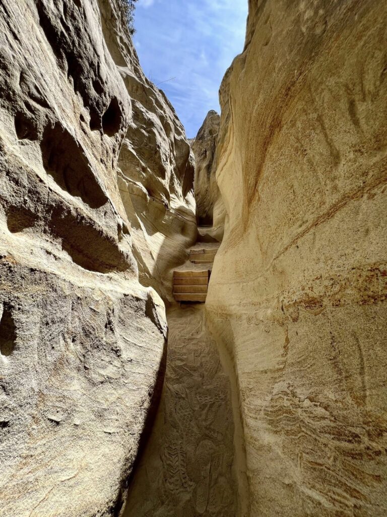
San Diego’s most unusual easy trail — a slot canyon with narrow sandstone passages, some requiring you to turn sideways, opening abruptly to lagoon views at the top. The slot canyon section takes about 20 minutes. The full loop adds wetland views and coastal scrub.
Parking lot off Manchester Avenue fills by 9 AM on weekends. Go early, or plan for a short walk from street parking. Most photogenic between October and March when light enters the canyon slot at lower angles.
13. Bayside Trail at Cabrillo National Monument
Distance: 2.5 mi · Elevation: Gentle · Drive from downtown: 15 min · Parking: $25/vehicle (free on foot/bike) · Dogs: ✅
Best for: Downtown skyline views, Bay panorama, history
The Bayside Trail gives you the best ground-level view of the Downtown San Diego skyline — the full bay, Coronado Bridge, and on clear days, Mexico in the distance. Paved then dirt, dropping along the eastern side of Point Loma. The $25 vehicle fee covers the Old Point Loma Lighthouse and the tide pools on the west side too — worth combining all three.
Arrive by 9 AM on weekends or the lot fills. Arriving on foot or by Bus Route 28 means free entry.
Best Moderate Hikes in San Diego
Moderate hikes in San Diego hit the sweet spot — real elevation, real views, and trails that challenge without wrecking your legs for two days after. Most are under 7 miles and accessible to anyone with a basic fitness level.
14. Cowles Mountain — San Diego’s Most Popular Hike
Distance: 3.0 mi RT · Elevation: 950 ft · Drive from downtown: 20 min · Parking: Free · Dogs: ✅
Best for: First summit, 360° city views, local rite of passage
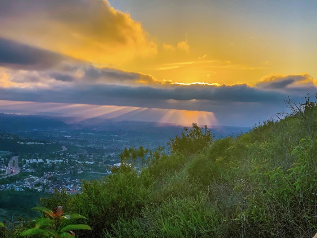
Cowles Mountain is the highest point within San Diego city limits at 1,592 feet — the summit gives you a genuine 360-degree view of downtown, the ocean, Mission Valley, and the Cuyamacas on clear days. Wide, well-maintained trail. It earns its spot as the go-to hike for every San Diegan eventually.
Main trailhead off Barker Way in San Carlos — fills by 8 AM on weekends. Quieter alternative: Big Rock Park trailhead on Golfcrest Drive, same mountain, different approach, significantly less crowded.
15. Iron Mountain — Best for Wildflowers
Distance: 6.6 mi loop · Elevation: 1,000 ft · Drive from downtown: 35 min · Parking: Free · Dogs: ✅
Best for: Spring wildflowers, panoramic summit, uncrowded moderate trail
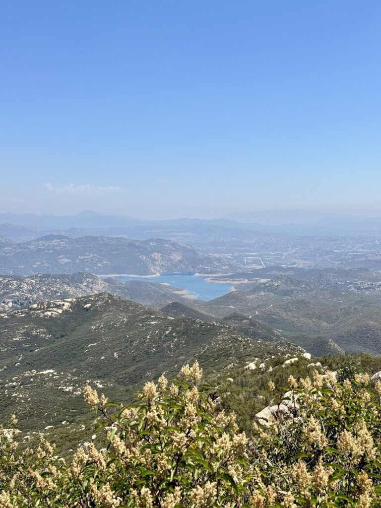
The hillsides go orange and purple with wildflowers February through April, and the summit views stretch from the Pacific to Palomar Mountain. Outside wildflower season it’s still a solid moderate hike — wide trail, consistent grade, panoramic summit at 2,696 ft. Free parking lot on Highway 67 in Poway rarely fills even on weekends.
16. Los Peñasquitos Canyon Preserve
Distance: 6.2 mi RT · Elevation: Low · Drive from downtown: 25 min · Parking: Free · Dogs: ✅
Best for: Waterfall, creek walking, shaded canyon, dog-friendly long walk
One of the least strenuous 6-mile hikes you’ll find, and one of the most rewarding. The canyon trail follows a creek — with actual running water most of the year — through coast live oaks, sycamores, and riparian vegetation. The destination: Peñasquitos Falls, a wide multi-tiered waterfall that’s genuinely impressive after winter rains.
Eastern entrance from Black Mountain Road is quieter. Western entrance at Canyonside Community Park has better parking. Browse hiking areas across San Diego for more canyon trail listings with maps.
17. Mission Trails — Climbers Loop
Distance: 4.2 mi · Elevation: 650 ft · Drive from downtown: 20 min · Parking: Free · Dogs: ✅
Best for: Urban park exploration, Old Mission Dam, quieter alternative to Cowles Mountain
Mission Trails Regional Park covers over 7,000 acres within San Diego city limits. The Climbers Loop covers the rocky eastern terrain with views of Mission Gorge and the Old Mission Dam — a California Historical Landmark. Quieter than Cowles Mountain despite being in the same park system.
18. Torrey Pines — Broken Hill Trail
Distance: 3.3 mi loop · Elevation: 350 ft · Drive from downtown: 20 min · Parking: $12–$25 · Dogs: ❌
Best for: Exposed coastal overlooks, photography, combining with Guy Fleming
Two dramatic sandstone promontories with unobstructed Pacific views and the reserve’s otherworldly eroded landscape. Combine with Guy Fleming in the same visit for a complete Torrey Pines experience — shared entrance and parking. Same dog restriction applies: no dogs on dirt trails (Torrey Pines State Natural Reserve rules).
19. South Clevenger Canyon Trail
Distance: 5.0 mi · Elevation: 800 ft · Drive from downtown: 45 min · Parking: Free · Dogs: ✅
Best for: Spring wildflowers, uncrowded, same payoff as Iron Mountain with fewer people
One of the best wildflower hikes in the county in February through April. Less crowded than Iron Mountain for the same seasonal payoff. Valley Center, 45 minutes from downtown. Free, no permit.
20. Daley Ranch Loop — Escondido
Distance: 7.0 mi loop · Elevation: 700 ft · Drive from downtown: 50 min · Parking: Free · Dogs: ✅
Best for: Oak woodland, quiet trails, mountain biking-friendly, historic ranch site
Oak woodland, a reservoir, and a historic ranch building all in one loop. Peaceful on weekdays. Trail sharing with mountain bikers on weekends — expect some two-wheeled company.
21. Stonewall Peak — Cuyamaca Mountains
Distance: 4.4 mi · Elevation: 900 ft · Drive from downtown: 60 min · Parking: $10/vehicle · Dogs: ✅
Best for: Mountain experience within a day trip, rock-cut stairs, snow in winter
Rock-cut steps lead to a granite summit at 5,730 ft — the most dramatic mountain hike accessible from San Diego in a day trip. The Cuyamaca range gets actual snow in winter and looks like a different ecosystem entirely compared to coastal San Diego. Best May through October.
Best Challenging Hikes in San Diego
San Diego’s hardest hikes demand early starts, minimum 3 liters of water, and sun protection. Two require advance permits. The payoff is access to 80-foot waterfalls, backcountry canyons, and summits most San Diego residents have never reached.
22. Potato Chip Rock (Mt. Woodson)
Distance: 7.5 mi (Lake Poway) or 4.2 mi (Hwy 67) · Elevation: 1,100–1,500 ft · Drive: 40 min · Dogs: ✅
Best for: Most Instagrammed summit in San Diego County
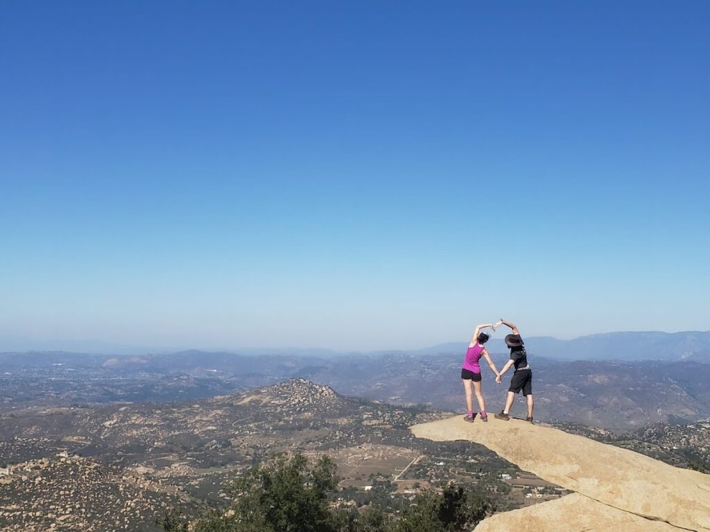
San Diego’s most photographed trail — a thin granite flake jutting above a 1,000-foot drop with views across the entire county. Two routes: Lake Poway (longer, more scenic, $10 weekend parking) and Highway 67 (free roadside parking, steeper). Weekend queues at the summit photo spot can run 30–45 minutes. Go on a Tuesday morning and you’ll wait five.
23. Cedar Creek Falls
Distance: 5.5 mi RT · Elevation: 1,200 ft descent · Drive: 55 min · Permit: Free, recreation.gov · Dogs: ❌
Best for: Best single waterfall in San Diego County, backcountry experience
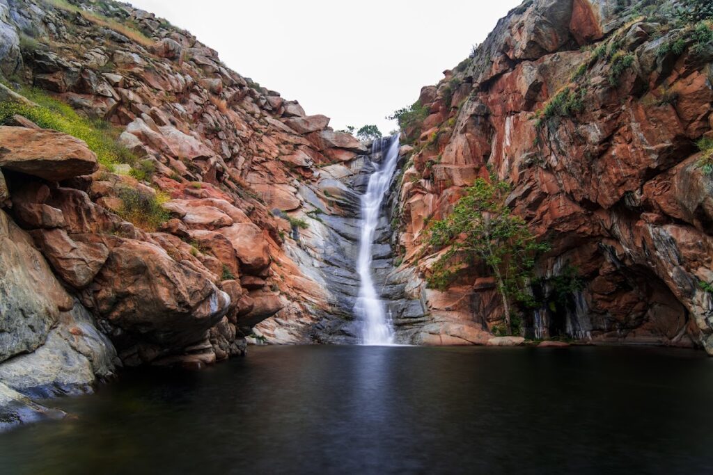
Cedar Creek Falls drops 80 feet into a clear pool in a setting that doesn’t look like Southern California. Trail descends steeply into Cleveland National Forest — which means you earn the climb back out. Peak season December through March. Permits are free but limited — popular weekends sell out within minutes of release, typically 3–7 days in advance. Book your Cedar Creek Falls permit at recreation.gov. No dogs permitted.
24. Three Sisters Falls
Distance: 5.0 mi RT · Elevation: 1,400 ft descent · Drive: 60 min · Permit: Free, recreation.gov · Dogs: ❌
Best for: Three cascading waterfalls, backcountry challenge
Three tiered waterfalls in a steep backcountry canyon. The most physically demanding descent in this guide — trekking poles are strongly recommended for the return. Book your Three Sisters Falls permit at recreation.gov — same free timed-entry system as Cedar Creek Falls. Trail may close temporarily during extreme heat (95°F+). Best December through April. No dogs.
25. El Cajon Mountain (El Capitan)
Distance: 10.4 mi RT · Elevation: 4,000 ft · Drive: 45 min · Parking: Free · Dogs: ⚠️
Best for: Biggest day hike in San Diego County, Salton Sea views on clear days
The most demanding day hike accessible from San Diego. El Cajon Mountain tops out at 3,675 ft — on clear days you can see the Salton Sea. Start before sunrise. Bring more water than you think you need. Dogs are technically allowed but not recommended due to the extreme grade and heat exposure. Trail is best avoided in August when temperatures regularly exceed safe hiking conditions.
Best Hikes in San Diego County (Beyond the City)
The best county hikes take you past the city limits into three completely different ecosystems — mountain pine forest, high desert, and oak woodland — all within 90 minutes of downtown.
Stonewall Peak (60 min) is covered above. Beyond that:
Anza-Borrego Desert State Park — California’s largest state park, 90 minutes east. Spring wildflower blooms (February–March in good rain years) are among the most spectacular in the American West. Multiple trail lengths and difficulties. Borrego Palm Canyon Trail (3.0 mi, moderate) is the most accessible introduction.
Palomar Mountain State Park — 75 minutes north. Conifer forest at 5,500+ feet, completely different ecology from coastal San Diego. Observatory Trail (2.0 mi) and Scott’s Cabin Loop (3.6 mi) are the strongest options.
Laguna Mountain Recreation Area — 60 miles east. Big Laguna Trail and Desert View Trail give you genuine mountain hiking with panoramic views east toward the Salton Sea and west toward the coast.
Browse the full list of hiking areas across San Diego County for trail listings with maps and current conditions.
Best Hikes Near Downtown San Diego — No Long Drive
If you live in East Village, Little Italy, Hillcrest, or North Park, you don’t need to fight the freeway on a Saturday morning.
| Trail | From Downtown | How to Get There | Fee |
|---|---|---|---|
| Balboa Park 7-Bridge Walk | 5 min / walkable | Walk from Bankers Hill or Hillcrest | Free |
| Palm Canyon (Balboa Park) | 5 min / walkable | Walk or rideshare | Free |
| Sunset Cliffs Walk | 10 min | Rideshare $10–12 or drive | Free |
| Tecolote Canyon | 12 min | Bus route 44 | Free |
| Bayside Trail | 15 min | Bus route 28 + short walk | Free on foot |
| Rose Canyon Trail | 18 min | Near UCSD Blue Line trolley | Free |
| Coast Walk (La Jolla) | 20 min | Rideshare or drive | Free |
For all trailheads with maps and parking: browse San Diego hiking areas.
Best Dog-Friendly Hikes in San Diego
Most San Diego trails allow leashed dogs. The exceptions in this guide: Cedar Creek Falls, Three Sisters Falls (no dogs permitted), and all Torrey Pines State Natural Reserve dirt trails (dogs allowed in parking and paved areas only).
Best dog-specific picks:
- Los Peñasquitos Canyon — the creek crossing midway is a highlight for dogs; multiple access points let you adjust distance
- Iron Mountain — wide trail, consistent shade in early miles, no technical terrain
- Cowles Mountain — highest concentration of dogs per trail mile in San Diego; you’ll have company
- Tecolote Canyon — quiet, shaded canyon bottom, almost no crowds even on weekends
- Mission Bay Loop — fully paved, flat, bay swimming accessible in some areas for dogs
California state parks including Torrey Pines and Cuyamaca restrict dogs to paved areas only. Enforcement has increased in recent years — check individual park rules before you go.
Best Time to Hike in San Diego by Season
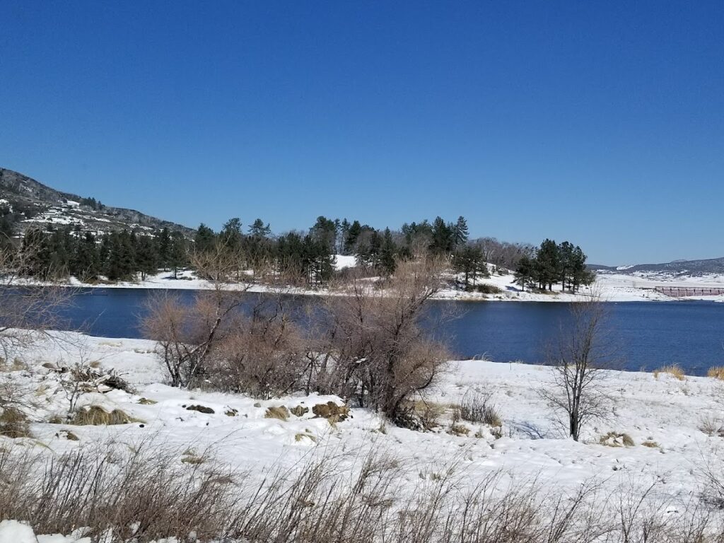
San Diego hiking is genuinely year-round. That said, each season has a different character and some trails have specific optimal windows.
| Season | Conditions | Best Trails |
|---|---|---|
| Spring (Mar–May) | Wildflowers, waterfalls running, 65–75°F | Cedar Creek Falls, Iron Mountain, South Clevenger, Three Sisters |
| Summer (Jun–Aug) | Marine layer burns off by late morning; inland gets hot fast | Coastal walks only. Torrey Pines, Sunset Cliffs, Coast Walk (La Jolla), Balboa Park |
| Fall (Sep–Nov) | Best all-around season. Clear skies, 70–80°F, long days | All trails. Cowles Mountain and El Cajon views clearest in October–November |
| Winter (Dec–Feb) | Rain activates waterfalls; Cuyamacas may get snow | Cedar Creek Falls, Three Sisters, Los Peñasquitos, Stonewall Peak |
The one tip that applies every season: arrive early. In San Diego, 7 AM on a Saturday means empty parking lots, ideal temperatures, and morning light on the trail. By 9:30 AM, most popular trailheads are full.
Permits, Parking & Practical Info
Permits (mandatory for two trails)
Cedar Creek Falls and Three Sisters Falls require a free day-use permit through recreation.gov. Timed-entry, limited — popular dates sell out within minutes of release, typically 3–7 days in advance.
Parking reality
- Cowles Mountain (Barker Way): fills by 8 AM weekends. Alternative: Big Rock Park on Golfcrest Drive
- Torrey Pines: $12–$25 demand-based pricing. Free street parking on North Torrey Pines Road below the reserve entrance
- Potato Chip Rock (Hwy 67 route): free roadside, fills by 8 AM weekends
- Most other trails in this guide: free, rarely a problem
Water and sun
Minimum 2 liters for any hike over 5 miles. 3 liters for moderate trails in summer; more for anything rated hard or inland. San Diego’s UV index is high year-round — hat and sunscreen are not optional.
Rattlesnakes
Present throughout San Diego County, most active spring and fall in the warmer part of the day. Stay on trail, don’t reach into brush or under rocks, give space if you see one. Common but bites are rare.
A Note on Trail Data and Conditions
Trail distances and elevation figures in this guide reflect commonly reported values from San Diego County Parks, California State Parks, Cleveland National Forest, and AllTrails community data. Figures may vary by route variation and trailhead used. Torrey Pines parking fees are demand-based and subject to change — verify at the California State Parks website before your visit. Cedar Creek Falls and Three Sisters Falls permit requirements are managed by Cleveland National Forest via recreation.gov; availability and requirements may change seasonally. Always check recent AllTrails reviews for San Diego before heading out to waterfall trails — conditions change significantly after rain events. This guide does not account for temporary closures; check park websites for current status.
FAQ
What is the most popular hike in San Diego?
Cowles Mountain is the most visited trail in the city — the summit at 1,592 ft is the highest point within San Diego city limits, and the 360-degree views include downtown, the ocean, and Mission Valley. Expect company on weekends; the Big Rock Park trailhead on Golfcrest Drive is a quieter alternative to the main Barker Way entrance.
What is the easiest hike in San Diego?
The Torrey Pines Guy Fleming Trail (0.9 mi, minimal elevation) is the easiest scenic hike. For something even simpler with zero elevation, the Coast Walk Trail in La Jolla (2.5 mi, flat, ocean views) and the Sunset Cliffs walk (1.5 mi, flat) are the strongest easy options. Both are free.
What are the best walking trails in San Diego?
For flat, no-elevation walks: Mission Bay Loop (5 mi, paved, fully flat), Tecolote Canyon (3.5 mi, shaded canyon), Coast Walk Trail in La Jolla (2.5 mi, ocean cliffs), and Batiquitos Lagoon Trail in Carlsbad (3.4 mi, wetland). All are free and dog-friendly.
What is the best hike in San Diego for beginners?
Cowles Mountain is the classic beginner summit — manageable grade, clear trail, real views at the top. For beginners who want something easier, Balboa Park’s Seven Bridges Walk (4.5 mi, minimal elevation, no fee) or the Coast Walk Trail in La Jolla (flat, ocean views) are the strongest no-stress options.
Can you hike in San Diego without a car?
Yes. Balboa Park walks are walkable from Bankers Hill and Hillcrest. Bayside Trail at Cabrillo National Monument is accessible via Bus Route 28 (free entry on foot). Tecolote Canyon has bus access via Route 44. Mission Bay Loop is near multiple bus routes. For most other trails, rideshare or a car is the practical option.
Do you need permits for San Diego hikes?
Only Cedar Creek Falls and Three Sisters Falls require permits — both free through recreation.gov, booked 3–7 days in advance. All other trails in this guide are permit-free.
What are the best hikes in San Diego County for waterfalls?
Cedar Creek Falls (80-foot drop, free permit required, best December–March) is the standout. Three Sisters Falls offers three cascades in one hike with the same permit system. Los Peñasquitos Falls (no permit, free, 25 minutes from downtown) is the best waterfall you can see without advance planning.
When are waterfalls running in San Diego?
Typically December through April depending on rainfall. In dry years, Cedar Creek and Three Sisters may run low by late February. After a wet winter, flows can continue through May. Check recent AllTrails reviews for San Diego trails before committing to the drive.
Is San Diego good for hiking year-round?
Yes — this is one of the genuine advantages of the climate here. Spring brings wildflowers and full waterfalls; fall has the clearest views; summer is best on coastal trails before 10 AM; winter activates backcountry waterfall trails. There is no month where hiking in San Diego is a bad idea, though inland hard hikes like El Cajon Mountain should be avoided in August.
Ready to explore more of the city? See our San Diego scenic spots directory for viewpoints, parks, and outdoor destinations beyond the trail — or check the complete San Diego guide for 2026 if you’re still planning your visit.